

For motorcycle enthusiasts, embarking on long trips offers the thrill of adventure and the opportunity to explore new landscapes. However, the success of such journeys often hinges on having the right navigation tools. Among the most essential gadgets for any rider are GPS devices and detailed maps, both of which play a pivotal role in ensuring a safe and enjoyable experience.
While GPS technology has revolutionized navigation by providing real-time directions, updated traffic information, and points of interest, traditional maps still hold significant value. They offer a broader perspective of the terrain and routes, something that can be crucial when venturing into remote areas where cellular signals may be weak or nonexistent.
Choosing the right navigation tools can make the difference between a smooth ride and a frustrating journey. This article will explore some of the top navigation solutions available for long motorcycle trips, highlighting their features, benefits, and how they can enhance your overall riding experience.
Choosing Between GPS Devices and Smartphone Apps for Route Planning
When planning long motorcycle trips, one of the critical decisions riders face is whether to rely on dedicated GPS devices or to use smartphone apps. Both options have unique advantages and disadvantages, making the choice dependent on individual preferences and travel requirements.
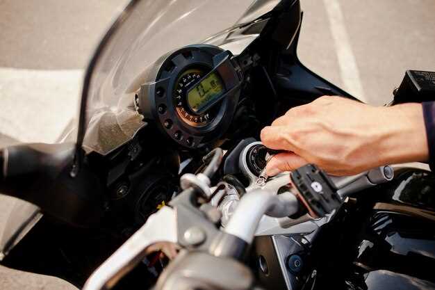
GPS devices are specifically designed for navigation, offering features tailored to the needs of long-distance riders. These devices typically provide larger screens, which can be easier to read while on the move. They often come with pre-loaded maps, which do not require a mobile data connection, ensuring reliability in remote areas where service may be limited. Furthermore, many GPS units are built to withstand harsh weather conditions, providing durability that can be crucial on long rides.
On the other hand, smartphone apps present a more versatile option. They can be easily updated with the latest maps and offer a wider range of route-planning features, such as crowd-sourced data on roads and traffic conditions. Additionally, smartphone apps often integrate with other applications, allowing for a more comprehensive planning experience, including places to stay and attractions to visit along the route. However, a potential downside is the reliance on battery life and cellular service, which may not be consistently available on remote highways.
Another consideration is user experience. Many riders prefer the tactile feedback and physical buttons found on GPS devices, making it easier to operate without taking their eyes off the road. In contrast, smartphone apps can leverage touchscreen functionalities but may require a more careful approach to avoid distractions.
In some cases, riders might choose to combine both methods. Using a dedicated GPS device for navigation while having a smartphone on hand as a backup or for additional features can provide the best of both worlds. This approach ensures that, regardless of the circumstances, navigation remains reliable and efficient throughout the journey.
Ultimately, the choice between GPS devices and smartphone apps for route planning comes down to personal preference, travel plans, and the specific demands of the journey. Whether using a rugged GPS or the convenience of smartphone technology, what matters most is ensuring successful navigation on the open road.
How to Read and Use Paper Maps for Motorcycle Navigation
Using paper maps for motorcycle navigation can be an enjoyable and rewarding experience, especially when technology fails or when you want to disconnect from GPS devices. To effectively read and utilize paper maps, start by familiarizing yourself with the map’s legend. The legend explains various symbols representing roads, campsites, gas stations, and other points of interest.
Next, identify your current location and goal. Determine the direction you want to travel and look for major roads and landmarks. It’s useful to locate your position using identifiable features like mountains or rivers that are also present on your map.
Understand the scale of the map, which indicates the distance between points. A smaller scale shows a larger area with less detail, while a larger scale focuses on a smaller area with more detail. This will help you estimate travel times and distances effectively.
Take note of the route options available. Some paper maps offer scenic routes, while others may feature faster highways. Consider your riding preferences and fuel stops when selecting the best course. Use a highlighter or pen to mark your planned route, ensuring you have a clear plan to follow.
When navigating, periodically check your surroundings and compare them with the map. Road signs and mile markers can help confirm your location and direction. If you find yourself off course, don’t panic; take a breath, pull over safely, and reorient your position by identifying nearby landmarks on the map.
To enhance your navigation experience, it can be beneficial to keep a backup GPS on hand. This way, you can switch between technology and traditional maps, ensuring you stay on the right path during your motorcycle journey. Embrace the adventure of navigating with paper maps, as it can lead to exploring hidden gems off the beaten path.
Integrating Technology with Traditional Methods on the Road
When embarking on long motorcycle trips, riders often face the challenge of navigation. Combining GPS technology with traditional maps can significantly enhance this experience. While GPS systems provide real-time updates and turn-by-turn directions, traditional maps offer a broader understanding of the terrain and landmarks, helping travelers to plan their route effectively.
Utilizing GPS ensures that riders can navigate quickly through unfamiliar areas. These devices or apps can display traffic conditions and suggest alternate routes, making the journey more efficient. However, relying solely on GPS may lead to overlooking scenic routes or interesting stops that are not marked digitally. This is where traditional maps come into play.
Maps encourage riders to explore beyond the beaten path, offering insights into historical sites, natural wonders, and hidden gems along the trip. They also serve as a reliable backup in case of GPS failure, which can occur due to poor signal or battery issues. Familiarizing oneself with map reading fosters essential navigational skills, ensuring a smoother journey.
To make the most of both navigation methods, riders can plan their routes using maps while programming key waypoints into their GPS devices. This hybrid approach allows for flexibility, enabling riders to adapt their journey as new opportunities arise. Ultimately, integrating technology with traditional navigation takes long motorcycle trips to a new level, blending the convenience of modern tools with the authentic experience of road exploration.